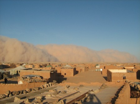
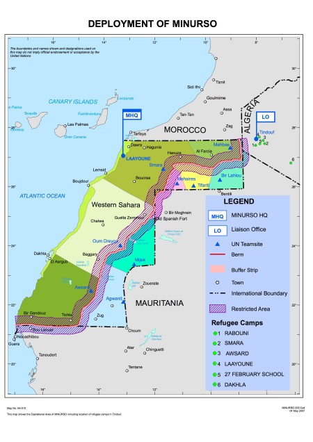
My friend and colleague Bachir sent me this photo of a dust storm engulfing one of the Sahrawi refugee camps (Auserd, to be precise) located around the Algerian town of Tindouf. The event occurred on 9 October between 17:00 and 19:00, and arrived from the northeast, heading southwest.
The storm was very unusual. Apparently large dust storms have never approached from the north, and this event was very unusual in being restricted to low altitude with a well-defined upper limit.
I’ve seen images and footage of similar-looking storms in the Sahel, associated with the passage of large, organised convective disturbances that generate rainfall during the monsoon season. These events are usually followed by heavy monsoon rains.
The event pictured here was followed (the next day) by heavy rains around sunset, which damaged homes in Smara camp.
It is reported that rains have been significant this year in the northern Algerian Sahara and Western Sahara. I’m told to expect Tifariti (in Western Sahara) to be very green in December, when I’m hoping to visit.
Whether or not we can expect more such events in the future is an open question. It’s generally expected that the Mediterranean areas north of the Sahara will become much drier, while there are a number of indications that the southern Sahara and the Sahel will become wetter (although this is by no means certain). The climate change projections in the IPCC Fourth Assessment Report suggest extreme drying of the Maghreb and of the most westerly regions of the Sahara south to about 15 degrees north. But again, these are not exactly bankable predictions, particularly towards the Sahelian zone.
Drier conditions may well mean less vegetation cover and more potential for the mobilisation of sand and dust from bare surfaces. On the other hand wetter conditions are likely to mean more powerful atmospheric disturbances that also mobilise dust. So the link between rainfall and dust is complex. Part of my PhD thesis examined the link between atmospheric disturbances and dust mobilisation in the Sahel. It appeared that increases in dust mobilisation were linked with a greater proportion of weak disturbances that were still strong enough to mobilse dust but not sufficiently vigorous to generate rainfall (not othe usual suspects of overgrazing and “inappropriate land use practices”). Stronger disturbances mobilise plenty of dust but the rainfall they subsequently generate behind the area of dust mobilisation washes it out of the atmosphere. Without the rainfall the dust just hangs around. However, that was in a region well to the south of the area in which the event pictured above occurred. When it comes to predicting the behaviour of dust events, things aren’t simply.
For more pictures of the 9 October event, see this photo set on Flickr. All the photos were taken by amateur photographers in the camps, and forwarded to me by Bachir, so credit where it is due.


 Posted by Nick Brooks